

New Delhi: An Indian satellite, unlike any the world has seen before, was launched into space on Sunday. Built by a private space start-up and designed to see through clouds and darkness, the mission marks a turning point for India’s space ecosystem.
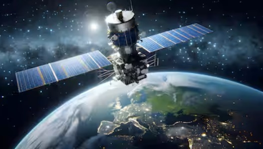
At the heart of this effort is Drishti, a uniquely engineered Earth observation satellite developed by Bengaluru-based GalaxEye and flown aboard SpaceX’s Falcon 9 rocket. The launch took place from California at 12.29 pm IST on Sunday.
“This satellite mission is called Drishti. Drishti stands for seeing through anything and everything in our context,” he said. “The speciality of this particular satellite is it has a multispectral camera and a synthetic aperture radar (SAR) imager on the same satellite. This is a first of its kind.”
If this was operational, India could have gotten quality images of the bomb damage assessments from Operation Sindoor rather than relying on commercial American satellites. In fact, the ongoing Israel, the US and Iran conflict has amply shown why countries need eyes in the skies from sovereign countries, as the US has barred space giant Vantor, earlier called Maxar, from sharing images from the conflict.

The idea for Drishti was born out of India’s geography and climate. Unlike temperate regions in the West, much of India lies in the tropics, near the Tropic of Cancer. Cloud cover is frequent and persistent, often rendering conventional optical satellites ineffective.
“We have found that India is a country which is tropical in nature. We have more clouds than the West,” Singh explained. “The West has never thought about this concept because they never had this problem. If they have a clean sky, they will have a clean sky. If they have some cloud, they will have it for some time, and then it will go away.”
A striking statistic drove GalaxEye to rethink satellite design. Citing a NASA study, Singh said, “At any given point in time, above the landmass, 70 per cent of the Earth is always covered by clouds. In the seas, it is 90 per cent. So seven out of ten imageries are going to be cloudy, especially on the tropical side.”
For users of satellite data, clouds are not just an inconvenience, they are a blindfold. Application layer users need reliable imagery, whether it is for disaster management, agriculture, infra-structure monitoring or security surveillance.
“Hence, we came up with this concept where we said is there a way to see through the clouds and still make sense out of it,” Singh said.
The answer was to combine two traditionally separate sensing technologies on a single satellite. Optical imaging offers clarity and colour, while synthetic aperture radar can image the ground regardless of cloud cover or lighting conditions.
Unlike many experimental missions, this satellite is neither tiny nor lightweight. GalaxEye’s spacecraft falls into a weight class that has usually been dominated in India by government missions. The weight class is around 190 kilograms, Singh said.
The launch itself marks another milestone. For its maiden mission, GalaxEye has chosen SpaceX.
India, too, is becoming familiar with Falcon 9. From Indian astronauts, like Group Captain Shubhanshu Shukla, to communication and Earth observation satellites, more Indian payloads are now entering orbit on the American workhorse rocket. GalaxEyes Drishti will join that growing queue.
Drishti is not a standalone experiment. It is the first member of an ambitious constellation. “We’re going to have a constellation. The success of the first satellite will actually have a follow on nine constellations,” Singh said. “Apart from being India’s heaviest satellite, I would say it is also one of India’s highest resolution satellites.”
Resolution is where Drishti aims to compete with the best in the world. The first satellite in the series will deliver imagery at around a 1.5-metre resolution, significantly sharper than the five-metre class that dominates many Indian SAR platforms.
“The first one we are going to do at 1.5 metres as the resolution as opposed to a regular five metres. Then the follow-on constellation will go even lower. We are going to try out 0.5 metres to 0.3 metres as well,” Singh said.
Crucially, both sensing systems are matched. “The speciality of the satellite is that both have the same resolution. One point five metre multispectral imagery and one point five metre SAR,” he said.